
William Michael Donato, A.A., ILA., M.A.
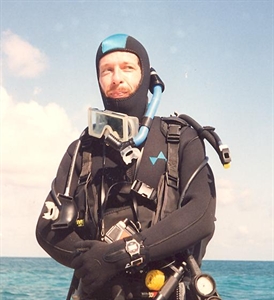
Bill Donato, Archaeologist
 Academic Degrees:
A.A. in Anthropology – 1971, Cypress College, Cypress, California.
B.A. in Anthropology – 1973, California State University Fullerton, Fullerton, California.
M.A. in Anthropology (emphasis in Archeology) – 1979, California State University Fullerton, Fullerton, California. Master’s Thesis: A Re-Examination of the Atlantis Theory (a 304 pa comprehensive survey and analysis of the pro’s and con’s relevant to the theory incorporating data from the multiple methodologies of anthropology, archeology, biology, ethnology, and geology with references to cross-cultural comparisons, possible evidences for catastrophism, and the way in which scientific paradigms may shape our outlooks). Master’s thesis copy available upon request.
Credentials:
Community College Instructor Credential – Subject Matter Area: Anthropology.
Community College Instructor Credential – Community College handicapped Student
Programs And Services Instructor and Services Credential – Specialization: Developmental Disabilities.
Occupations:
-Archeologist and Archeological Consultant.
-Qualified Mental Retardation Professional and Administrator at two intermediate care facilities for developmentally disabled adults with nursing care needs.
-Community Integration Consultant at a facility for developmentally disabled adults.
-Qualified Mental Retardation Professional/Program Consultant at four facilities.
-Founder and editor of The Atlantis Organization (T.A.O.), a scientifically oriented research an networking organization and newsletter focusing on archeology and alternative theories and technologies.
Archeological Background:
1972 Initial fieldwork at El Morro Canyon (site 4 ORA) in Laguna Beach, California, with California State Fullerton’s Archeological Field Methods Class.
1974 First research trip to Bimini. Took aerial photographs of underwater feature off of East Bimini that was later incorporated into the master’s thesis.
1979 Employed as Field Archeologist by California State Fullerton’s Public Antiquities Salvage Team (P.A.S.T) at the Newland House site in Huntington Beach, California.
1989 Participated in the first Quest For Atlantis conference, a symposium held on Bimini created by Vanda Osmon, Dr. Joan Hanley, and Dr. David Zink which examined the historical development of the Atlantis theory. Gave an oral presentation and rediscovered the “Fish (or ‘Shark’) Mound” during an aerial survey (originally discovered by Jim Richardson, an associate of Dr. J. Manson Valentine). Identified the feature as a “zoomorphic effigy mound”.
1990 Participated in second Quest For Atlantis conference as a presenter and led the team (composed of Vanda Osmon, Dr. Joan Hanley, and Dr. Doug Richards) to the first on-site investigation of the “Rectangular Mound”. Discovered a monolith on the “Bimini Road”.
1990-1991 Discovery and on-site visual investigation of possible mounds on northern section of North Bimini.
1991 Participated in third Quest For Atlantis conference orchestrated by Vanda Osmon, Dr. Joan Hanley, and Dr. Doug Richards, as a presenter and did an on-site visual exam of the “Fish Mound” with other members. Co-discoverer of the “Cobra Mound” with Raymond Leigh, Jr., from his aerial infrared color photographs.
1991 Became one of the editors of Jean Hunt’s Louisiana Mounds Society newsletter, an investigative archeological organization composed of both professionals and amateurs.
1991 Research trip to Mexico. Investigated the sites of Tenayuca, Teotihuacan, and Tula.
1992 On-site visual investigation of East Bimini’s “Dolphin Mound”. Did aerial survey and photographed a large feature underwater off of South Bimini resembling a “Pentagon”, another resembling a “Hexagon’, and the “Sea Horse Mound” on East Bimini.
1992 Gave professional presentation on the new archeological discoveries in the western Bahamas before the Institute for the Study of American Cultures in Columbus, Georgia. This was followed by a similar presentation in Troy, Texas for private parties.
1993 Obtained proper requirements and began “Project; Alta”, which included the first comprehensive side-scan sonar survey since that done by Dr. Harold Edgerton and Dr. David Zink in the Bimini area (North Bimini to Cat Cay). Team members included Vanda Osmon, Thomas Vanderveer, Frank Joseph, Donnie Fields, and Dr. Claude Swanson. It included an on-site visual examination of the “Cobra Mound” and the discovery of some man-made features on the “Bimini Road”. This project entailed three separate trips and was documented by John McKinney (Jack McKinney Productions) for the Discovery Channel. Further aerial surveys done.
1994 Research trip to Peru and Bolivia investigating the sites of Cusco, Tambo Machay, Amaru Machay, Kenko, Sacsayhuaman, Machu Picchu, Ollantaytambo, Sillustani, the Island of the Sun, Tiahuanaco, and other sites with a focus on architectural elements.
1995 Continuation of “Project: Alta” under permits obtained by Granite Productions and George Stover, Ill, Adventure Productions. Aerial survey and the discovery of large mortised stone on the “Bimini Road”. Also discerned unique form of mortise on stone discovered by Bill Keefe which was later determined to have tool marks by the University of Colorado.
1996 Presenter for the first Ancient American conference detailing the discoveries in the western Bahamas. Hired to investigate a petroglyph site in Utah.
1997 Obtained proper requirements for continuation of “Project: Alta”. Extensive aerial survey of the northern section of the Great Bahama Bank and the vicinity of northern Andros
with the discovery of several potential site areas and target reacquisition of features initially discovered by Dr. Valentine and Dirnitri Rebikoff (obtaining G.P.S. coordinates for all). Obtained G.P.S. coordinates for all significant points of the “Fish”, “Cat”, and “Rectangle” mounds. Continued investigations on the “Bimini Road”. Obtained magnetic coordinates of significant points on the “Fish Mound”.
1998 Obtained proper requirements for continuation of “Project: Alta”. On-site investigations at Anguilla Cay (underwater and on the surface). Proved that an alleged “pyramid” was simply a sea-mount and two miles off of where the map indicated. Four day side-scan survey to the west of Bimini going southward. Submarine investigation of 1993 targets. An aerial circumnavigation of Andros revealed several potential new sites and the relocation of another first noted by Dr. Valentine, and a feature with the shape of a large “Pentagon” with a fresh water spring was located east of South Cat Cay. Discovery of ancient man-made cut on base stone of the “Bimini Road.” Review of side-scan images showed several targets with anomalous features, some resembling architecture. This was in June.
1998 Accompanied Dr. Joan Hanley’s group in May. As a professional courtesy data on four of the June side-scan targets, and one of the 1993 targets, was shared so that the “tech divers” might get photographic and/or videotape verification of them. Documented three-layered feature on the “Bimini Road” discovered by Donnie Fields, and discovered another.
1999 Obtained proper requirements for continuation of “Project: Alta”. Sought reacquisition of June 1998 side-scan sonar targets via side-scan sonar, underwater video-cameras, and submarine (two-man “Nekton Gamma” submarine). New targets were obtained. Discovered that the 1998 targets G.P.S. coordinates were in error longitudinally. Side-scan technician (of manufacturer’s) verified that the anomalous images were of “hard” targets. Expert contracted to reacquire targets with corrected data.
2001 Nonprofit corporation “A.P.E.X. Institute” (acronym for “Advanced Planetary EXplorations”) formed to investigate archeological anomalies with a general focus on underwater sites. Several projects at different site locations in the Bahamas (each with significant anomalies) have been proposed. Future projects are proposed for the Yucatan and sites in the Pacific Ocean.
2002 First A.P.E.X. Institute activity, a continuation of “Project: Alta”. The project was designed to verify the 1998 side-scan sonar targets and look for new sites obtained with satellite derived data, as well as investigate the Cat Island anomaly, the triple concentric arc. Though freak weather conditions prohibited doing the side-scan project (wind, rain, and bad sea conditions) the contracting agency gave us a $10,000.00 credit toward doing it later if tied to another project. The Cat Island initial survey project was completely successful with two made dives inside the outer arc and the discovery of a possible limestone artifact which was photographed underwater. Surface investigation of the outer arc revealed that coral was covering flat limestone, possibly indicating a modified or artificial feature or construction.
Involved in private astro-archeological research project at a rock painting site in the Cleveland National Forest (California) for approximately seven years. Results indicate that it is a solstice marker. More data is still needed to ascertain whether it is also an equinox marker. An administrative pass was granted for this study. This is an ongoing project that began in 1995.
Media Appearances:
Secrets of the Deep: “The Hunt for Atlantis” – the Discovery Channel . The first “Project: Alta” expeditions’ side-scan sonar investigation was filmed by John and Noreen McKinney of “Jack McKinney Productions” in 1993 and broadcast in 1994. Approximately thirty anomalies were registered, including a large underwater “hexagon”.
Arthur C. Clarke’s Mysterious Universe: “Secrets of Ancient Worlds” – the Discovery Channel, filmed in 1995 and broadcast in 1996.
Secrets of Bimini: When Spirits Come Calling: a film by George A. Stover, III, of ”George Stover Adventure Productions” in 1995. I was interviewed as an archeological authority on the anomalies of Bimini. During one of the filmed dives on the “Bimini Road” I discovered an “in situ” stone with a tenon on one side.
The Laura Lee Show: syndicated national radio program interview, broadcast in 1996.
Ponkikeies – Ga-Cha-Pin: a Japanese children’s program in association with Buena Vista (a Disney affiliate) in October 2001. The long-running and successful educational children’s program was doing a promotional episode to publicize the release of the Disney Corporation’s feature length animated movie “Atlantis, the Lost Empire” and I was chosen to be the archeologist their costumed character “Ga-Cha-Pin” talked to about Atlantis on Bimini because of my background in that subject and in education. It included dives on the “Bimini Road” and several other locations and a story line that connected it to the movie.
Truth or Dare: The Bermuda Triangle: a cable network children’s program on unusual and mysterious topics. I was chosen for an interview because of my background in the Atlantis subject matter and research in the Bahamas. The interview concerned the archeological discoveries made in the Bahamas and what might be some possible explanations for the disappearance of ships, planes, and people in the “Bermuda Triangle”.
Articles:
“Bimini and the Atlantis Controversy: What the Evidence Says”. The Ancient American, Vol. 1 No. 3, Nov./Dec. 1993.
“What You Did Not See (or Hear) On Arthur C. Clarke’s Mysterious Universe”. The Ancient American. Vol.3, No. 14.
“New Find At The Bimini Road”. The Ancient American, Vol. 3, No. 16.
“Bimini Granite Re-classified — And It’s Still Out Place!”. The Ancient American, Vol. 3, no. 1
“Atlantis at Bimini: Fantasy or Fact?”. Bahamas Handbook and Businessman’s Annual 1999. Etienne Dupuch Jr. Publications, Nassau, Bahamas. [This was a “point/counter point’ article with me being recommended by the author with the contrasting opinion. Though I volunteered to do the article without payment as I thought that it might help bring in investors and tourism to the Bahamas, they insisted as a matter of policy that I take payment.]
Two cover photographic credits for The Ancient American.
“Revisiting Edgar Cayce’s Caribbean Atlantis – Could New Discoveries Vindicate More Than Thirty Years of Intense Research?”. Atlantis Rising #30.
“Cayce’s Fire Stone: Did the Sleeping Prophet Accurately Describe Masers and Lasers?” – “Cayce’s Masers”. Atlantis Rising #32.
“Atlantide emerge a Bimini”. Hera # 37.
Note: the first Bahamas/Atlantis related article appeared in Unicus magazine in the early 1990’s. also served as the “Bimini/Atlantis” editor for the Louisiana Mounds Society newsletter during the early 1990’s.
Lectures and Slide Presentations:
-Unicus magazine sponsored presentation put on by its editor, Robert Stanley, in Santa Monica, California.
-Middle school class presentation at Special Education class in the Los Angeles County School District.
-One of the featured presenters for the Institute for the Study of American Cultures in Columbus Georgia, in 1992.
-Private slide/lecture presentation in Troy, Texas, in 1992 following the Georgia presentation.
-One of the featured presenters for the Ancient American magazine sponsored conference at Salt Lake City, Utah, in 1997.
-Presenter at the Association for Research and Enlightenment’s “Atlantis” conference in 1999 at Virginia Beach, Virginia, describing the discoveries that had been made in the Bahamas since 1989 and our own group’s (“Project: Alta”) most recent projects, especially the side-scan sonar discoveries of possible underwater structures.
-Presenter at the International U.F.O. Conference in Laughlin, Nevada, in 2002 detailing the Bahamian discoveries and giving the then current status of the underwater Cuban site.
-Speaker at The Eclectic Viewpoint sponsored presentation in Dallas, Texas, in 2002 describing the newest discoveries in the Bahamas and the potential of the Cat Island site.
ADDENDUM
July, 2003 Week long expedition mostly funded by our nonprofit organization, A.P.E.X. Institute (and myself), to Bimini to obtain further data on potential high priority archeological target sites. We were attempting to better define the target areas, to determine what technologies would be most efficacious, and to refine our methodologies so that future project(s) can be done more cost effectively and more efficiently. One of our goals was to locate an underwater feature in the shape of a “pentagon” several acres in extent between South Cat Cay and Ocean Cay and to do an initial on-site investigation to determine if there was a stone foundation within reach of our probing rods under the sea grass or whether we would need sub-bottom profiling to make such a determination. A second goal was to investigate a feature off of East Bimini in the shape of a “rectangle” approximately 1/2 by 1/4 mile in size to determine whether there is a stone foundation within the range of our probing rods or whether sub-bottom profiling would be needed. A third goal was to investigate a 1,600 foot set of parallel lines that Jonathan Eagle had discovered from satellite photos from a project that the A.R.E. had funded. A fourth goal was to investigate two circular features (also in the satellite data) south of South Bimini. A fifth goal was to obtain bottom feature and depth data on the western side of Bimini for the purpose of helping any future side-scan sonar or sub-bottom profiling activities. We were able to complete all of our investigations. We located the Pentagon, did an on-site investigation, and determined that sub-bottom profiling will be necessary. The water is about 14’ deep at that location. A feature resembling a “hexagon’ was also sighted about two miles to the east of the Pentagon. The Rectangle could be penetrated down to 9’ (the limit of the rods size), showing that if stone is present it is deeper. If a stone foundation is present at approximately 10’ to 12’ it would date to about 10,000 B.C. Sub-bottom profiling will be necessary to determine this. Since the northeast corner is deepest at about 6’ this could be scanned, but much of it could not because it goes to about 3’ in depth. While investigating the two 1,600’ lines Jonathan Eagle noted a severe temperature discrepancy: the water at the surface was about 78 degrees, while that at the bottom was approximately 90 to 95 degrees. The Pentagon, Rectangle, and Parallel Lines are all defined by sea vegetation, typically sea grass. We located the two circular features with no difficulty and our probing rods hit stone in both locations. Bottom feature data was obtained from the western side of Bimini down to the vicinity of Cat Cay. Unusual formations were noted in deeper water on the western side of North Bimini, fairly close from a perspective of latitude to that at which the Bimini Road is located. We are currently seeking renewal of our permit to do side-scan sonar and to get permission from the Bahamian government to add sub-bottom profiling to it.